Rychleby Trails
aktuálně 4.5 °C slabý déšť
19.04. | slabý déšť | 6.3 °C
20.04. | sněžení | 3.0 °C
21.04. | zataženo | 4.1 °C
Černá Voda 193 , 790 54 Černá Voda, Czechy

Contact:

+420 607 061 445
Černá Voda 193
790 54 Černá Voda, Czechy
Plan route
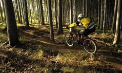
Rychleby Trails

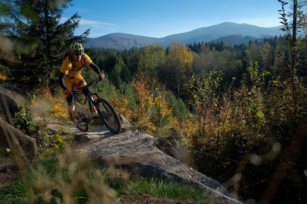
Do you ride a mountain bike? Do you like riding along narrow paths? Now there are Rychleby Trails for you.
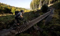
Rychlebské stezky (Rychleby trails) is network of trails which are specifically designed for enjoyable ride on mountain bike in close touch with nature. One can find here both old rocky paths as well as modern flowy trails. All trails are passable in the rainy weather, too. Rychlebské stezky trails start and finish in the village of Černá Voda at Information Centre Rychlebské stezky. Trails are built as closed circuits to enable visitors stray-free experience. Information Centre provides related services such as test centrum of full suspension bikes, mountain bike school, bike café, bike shop, bike maintenance and repair shop, souvenirs.

Trails:

There are three main options how to ride through the trails under Falcon Peak:

previous | next 1 / 39
0%
Rychleby Trails - Trail Dr. Wiessnera

Rychleby Trails - Trail Dr. Wiessnera

The only ascending trail that leads you to trails under Sokolí vrch and the SuperFlow.
Obtížnost: lehká
Čas: 135 minut
Délka: 7.10 km
Zážitek:
Stoupání: 415 metrů
Klesání: 15 metrů
Krajina:
Nejvyšší bod: 762 m.n.m.
Nejnižší bod: 346 m.n.m.
Rychleby Trails - Trail podél Černého potoka

Rychleby Trails - Trail podél Černého potoka

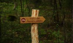
Podél Černého potoka (Along Black Brook) Trail. As the name suggests, the trail runs along the Black Brook. An easy trail, there are numerous beautiful locations and scenic lookouts for every-day o ... (more)
Obtížnost: lehká
Čas: 173 minut
Délka: 28.89 km
Zážitek:
Stoupání: 132 metrů
Klesání: 132 metrů
Krajina:
Nejvyšší bod: 347 m.n.m.
Nejnižší bod: 236 m.n.m.
Rychleby Trails - Wales

Rychleby Trails - Wales

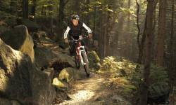
The trail called Wales is the highest trail and among the most demanding. It will challenge the biker's technical skills in both ascending and descending passages. As a reward, it takes the visitor no ... (more)
Obtížnost: těžká
Čas: 24 minut
Délka: 1.69 km
Zážitek:
Stoupání: 58 metrů
Klesání: 72 metrů
Krajina:
Nejvyšší bod: 818 m.n.m.
Nejnižší bod: 747 m.n.m.
Rychleby Trails - SuperFlow trail

Rychleby Trails - SuperFlow trail

New unique route for bikers of all levels of performance we have built with Rowan Sorrell of the company Back on Track, who is the author of the best trails in recent years originated in the UK. Super ... (more)
Obtížnost: středně těžká
Čas: 59 minut
Délka: 10.90 km
Zážitek:
Stoupání: 49 metrů
Klesání: 442 metrů
Krajina:
Nejvyšší bod: 759 m.n.m.
Nejnižší bod: 345 m.n.m.
Rychleby Trails - Biskupský, Tajemný, Mramorový, Sjezdy

Rychleby Trails - Biskupský, Tajemný, Mramorový, Sjezdy

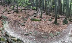
Moderate difficulty downhill trail under Sokolí vrch. Biskupský (Bishop's), Tajemný (Mysterious) and Mramorový (Marble) The experience is enriched by overcoming shallow fords streams, either o ... (more)
Obtížnost: středně těžká
Čas: 47 minut
Délka: 9.64 km
Zážitek:
Stoupání: 43 metrů
Klesání: 443 metrů
Krajina:
Nejvyšší bod: 747 m.n.m.
Nejnižší bod: 346 m.n.m.
Rychleby Trails - Prokletý, Mramorový, Sjezdy

Rychleby Trails - Prokletý, Mramorový, Sjezdy

Moderate difficulty downhill trail under Sokolí vrch with a hard difficulty stretch of trail Prokletý (Cursed). Prokletý (Cursed) and Mramorový (Marble) The experience is enriched by overcom ... (more)
Obtížnost: středně těžká
Čas: 28 minut
Délka: 6.55 km
Zážitek:
Stoupání: 6 metrů
Klesání: 403 metrů
Krajina:
Nejvyšší bod: 747 m.n.m.
Nejnižší bod: 346 m.n.m.
Weather
4.5 °C
Webcams
Accommodation
Yescard discount card
Transport in Jeseníky